Where Is Aruba Located?
Aruba sits at 12.5°N latitude and 69.9°W longitude in the Southern Caribbean Sea, just 15 miles (25 km) north of Venezuela. This location places it outside the hurricane belt and gives it a distinct arid climate unlike typical tropical Caribbean islands. The island is the westernmost of the ABC Islands (Aruba, Bonaire, Curaçao) in the Dutch Caribbean.
Aruba’s Position in the Southern Caribbean Sea
Aruba’s coordinates at 12.5°N latitude and 69.9°W longitude position it in the southern reaches of the Caribbean Sea, closer to South America than to the Greater Antilles. This southern location creates different ocean currents and weather patterns compared to northern Caribbean islands. The surrounding waters maintain exceptional clarity and calm conditions, particularly on the western coast.
Aruba’s Proximity to the Coast of Venezuela
The island lies just 15 miles (25 kilometers) north of Venezuela’s Paraguaná Peninsula. On clear days, Venezuelan mountains are visible from Aruba’s southeastern coast. This proximity has shaped the island’s cultural exchange and economic ties with South America.
| Location | Distance from Aruba |
|---|---|
| Venezuela (Paraguaná Peninsula) | 15 miles (25 km) |
| Curaçao | 48 miles (77 km) |
| Bonaire | 86 miles (138 km) |
Aruba as Part of the Leeward Antilles and ABC Islands
As the westernmost island of the ABC Islands (Aruba, Bonaire, Curaçao), Aruba belongs to the Leeward Antilles in the southern Lesser Antilles chain. The ABC Islands share similar geological foundations and arid climates, distinct from the volcanic Windward Antilles. Aruba maintains the most developed tourism infrastructure among the three islands.
What Defines the Unique Geography of Aruba?
Aruba features a tropical semi-arid desert landscape with cacti, aloe vera, and wind-bent Divi-divi trees instead of rainforests. The island’s geology includes ancient limestone formations, volcanic rocks, and massive boulder clusters. Its beaches contain crushed coral and shell sand that stays cool to the touch, unlike typical silica sand.
How Does the Arid Landscape Differ from Other Caribbean Islands?
The island’s tropical semi-arid climate supports desert vegetation including cacti, aloe vera, and Divi-divi trees permanently bent by trade winds. This dry terrain produces minimal runoff, resulting in exceptional water clarity around the island. The low humidity and sparse rainfall preserve the distinctive desert scenery year-round.
What Geological Formations Shape the Island?
Aruba’s foundation combines volcanic rocks, limestone, and quartz diorite from ancient underwater formation and uplift. The island is not actively volcanic. Key geological features include:
- Hooiberg – a cone-shaped volcanic formation rising from the island’s center with panoramic views,
- Ayo and Casibari Rock Formations – massive monolithic boulder clusters offering unique hiking,
- Limestone Terraces – fossilized coral reefs along the coast showcasing geological history.
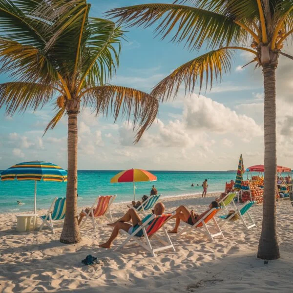
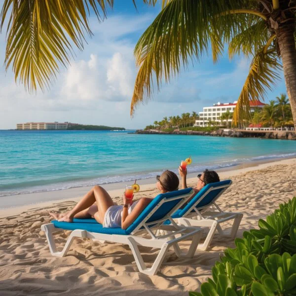
Why Are Aruba’s White Sand Beaches Unique?
Aruba’s beaches, particularly Eagle Beach and Palm Beach, feature crushed coral and shell sand rather than silica. This composition keeps the sand cool even in peak heat, allowing comfortable barefoot walking. The powder-white sand combined with calm turquoise waters on the western and southern coasts creates world-class beach conditions.
Why Is Aruba’s Climate Considered Unique?
Aruba sits outside the hurricane belt with a tropical semi-arid climate receiving only 15-20 inches of rain annually. Temperatures average 82°F (28°C) year-round with constant cooling trade winds from the east. This creates 365 days of sunshine with low humidity, unlike most Caribbean destinations.
How Does Being Outside the Hurricane Belt Benefit Aruba?
Aruba’s southern location places it outside the hurricane belt, with extremely low probability of tropical storm impacts. While most Caribbean islands face hurricane threats from June to November, Aruba remains safe year-round. This stability supports consistent tourism and economic investment without storm-related disruptions.
What Characterizes the Tropical Semi-Arid Climate?
The island receives only 15-20 inches of annual rainfall, mostly in short late-year showers. This desert climate maintains consistent conditions throughout the year with:
- consistent temperatures – average 82°F (28°C) year-round,
- low humidity – dry air unlike typical tropical destinations,
- abundant sunshine – more sunny days than almost any Caribbean island.
How Do the Trade Winds Affect the Weather?
Constant easterly trade winds act as natural air conditioning, preventing oppressive heat despite the equatorial proximity. These winds shape the southwest-pointing Divi-divi trees, create excellent windsurfing conditions, and keep mosquitoes minimal compared to windless islands.
What Distinguishes Aruba’s Culture and Heritage?
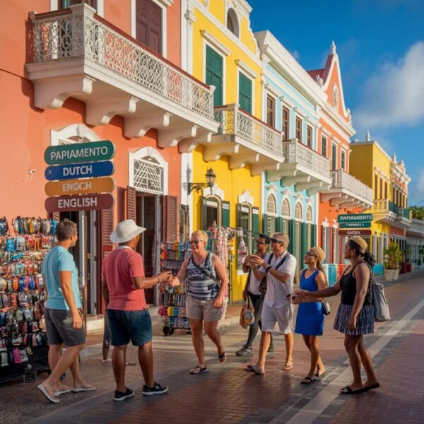
Aruba blends Dutch colonial governance with Caribbean and Latin American influences, creating a multilingual society where most residents speak four languages: Papiamento, Dutch, English, and Spanish. Over 90 nationalities coexist peacefully, with Papiamento—a creole mixing Portuguese, Spanish, Dutch, African, and Arawak roots—serving as the cultural heart.
How Does the Dutch Influence Shape Local Culture?
As part of the Kingdom of the Netherlands, Dutch influence appears in Oranjestad’s colonial architecture featuring Dutch gables in Caribbean pastels. The island integrates Dutch educational systems and efficiency with Caribbean relaxation. Celebrations like King’s Day are observed enthusiastically, and Dutch serves as an official language in government and schools.
What Is the Significance of the Papiamento Language?
Papiamento is a creole language evolved from Portuguese, Spanish, Dutch, African dialects, and Arawak roots, representing the ABC islands’ cultural identity. Most Arubans speak four languages fluently:
- Papiamento – native tongue for daily life,
- Dutch – language of administration and law,
- English – widely spoken for tourism,
- Spanish – common due to Venezuelan proximity.
How Do Diverse Cultural Influences Create a Unique Society?
Over 90 nationalities live peacefully on the island, with South American proximity bringing strong Latin influences to music, dance, and cuisine. The society blends Dutch cheeses with Caribbean stews and South American meats, celebrates Carnival with grand parades rivaling Brazil or Trinidad, and maintains an open, welcoming atmosphere known as “One Happy Island.”
What Is Aruba’s Political Status and Economy?
Aruba is a constituent country within the Kingdom of the Netherlands since 1986, with autonomy over internal affairs while the Kingdom handles defense and foreign policy. The economy relies heavily on tourism (majority of GDP), with the Aruban Florin (AWG) as official currency, though US Dollars are widely accepted at approximately 1.79 AWG to 1 USD.
How Does Aruba Function Within the Kingdom of the Netherlands?
Aruba obtained “Status Aparte” in 1986, granting autonomy over internal affairs while the Kingdom of the Netherlands manages defense and foreign policy. This political status provides stable democratic governance and a Dutch-based legal system. A Governor represents the Dutch Monarch, while the island operates under its own Prime Minister and Parliament.
What Drives Aruba’s Economy and Tourism Industry?
Tourism accounts for the majority of GDP, creating one of the Caribbean’s highest living standards through a robust service sector. Key economic drivers include:
- high-end tourism – luxury hotels, timeshares, and cruise tourism,
- oil refining (historical) – less dominant now but historically significant,
- offshore banking and technology – growing diversification sectors.
What Currency Is Used in Aruba?
The official currency is the Aruban Florin (AWG), pegged at approximately 1.79 AWG to 1 USD. US Dollars are widely accepted throughout the island, with prices often displayed in both currencies. This dual-currency system simplifies transactions for international visitors and provides economic stability.
What Unique Biodiversity and Natural Attractions Does Aruba Offer?
Aruba’s waters contain vibrant coral reefs and the Antilla shipwreck (one of the Caribbean’s largest), supporting diverse marine life including sea turtles. On land, endemic species include the Aruban Whiptail Lizard, Aruban Rattlesnake, and Burrowing Owl (Shoco). Arikok National Park covers 20% of the island, preserving limestone caves, lava formations, and natural pools.
What Marine Life and Coral Reefs Can Be Found?
Fringing coral reefs surround the island, accessible from shore for snorkeling and diving. The underwater environment features the Antilla Shipwreck (one of the Caribbean’s largest wrecks functioning as an artificial reef), vibrant coral gardens hosting parrotfish, angelfish, and moray eels, and several sea turtle species that nest on island beaches.
What Flora and Fauna Are Endemic to the Island?
Terrestrial species adapted to arid conditions include several endemic or regionally specific animals and drought-resistant plants:
- Aruban Whiptail Lizard (Kododo) – bright blue lizard frequently seen on rocks,
- Aruban Rattlesnake (Cascabel) – rare endemic species in the wild interior,
- Burrowing Owl (Shoco) – national symbol nesting in the ground.
Flora includes towering Kadushi cacti and drought-resistant Aloe plants, once a major export.
How Does Arikok National Park Preserve Island Biodiversity?
Arikok National Park protects approximately 20% of the island’s landmass, preserving diverse landscapes from lava formations to limestone caves with ancient Indian drawings, native habitats for endemic rattlesnakes and burrowing owls, and natural pools (Conchi) formed by volcanic rock on the windward coast. The park limits development and manages tourism to maintain the intact island ecosystem.